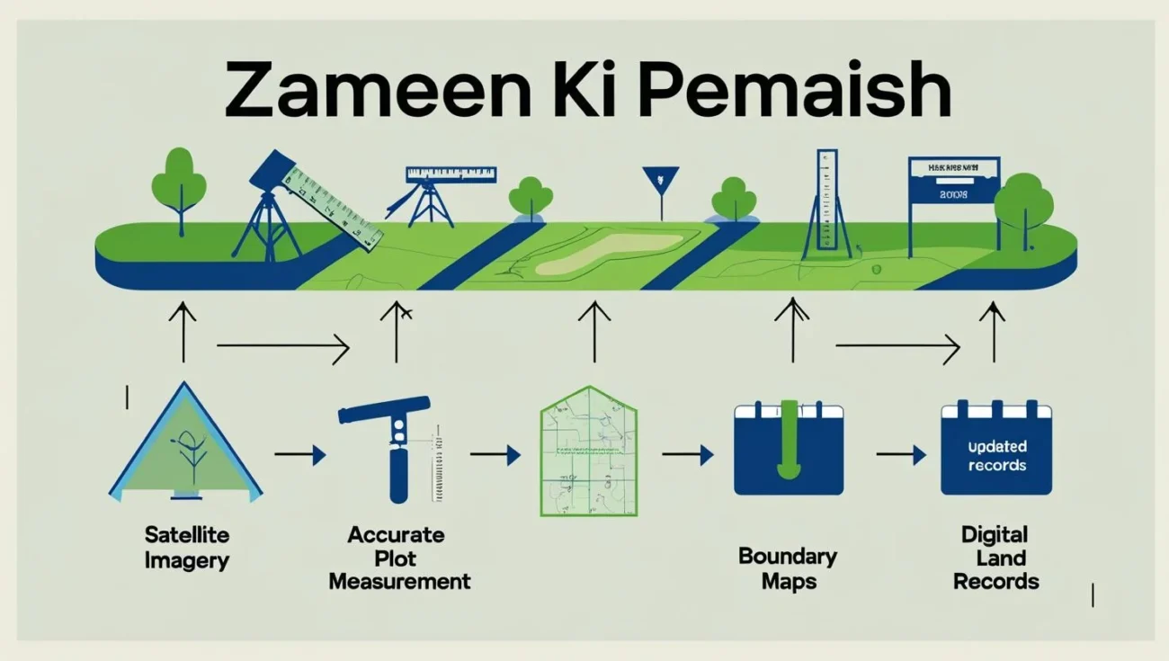
Zameen ki pemaish translated as land measurement encompasses the distinct practices of surveying and zoning and holds particular significance in Pakistan pertaining to issues of land ownership, real estate controversies, agricultural management, and urbanization of infrastructure including real estate projects due to the fertile land along the Indus River. Land, as one of the most critical resources in Pakistan, demands precise documentation to avoid issues arising from boundary conflicts, divorce, partition, or even state-sponsored projects.
These conflicts often lead to ancillary problems of illegal land claim, family feuds, and chaos, posing profound socio-economic ramifications, thus making zameen ki pemaish vital for sociopolitical order. Consequently, state institutions, land registries, and agricultural revenue offices impose stringent regulations to prevent land ownership discrepancies.
Why Zameen Ki Pemaish is Important in Pakistan
The agricultural and real estate industries in Pakistan are fundamentally reliant on well-maintained land record systems. Zameen ki pemaish not only legally protects ownership but also shields landowners from various types of fraud. For the purpose of updating records with the governing authorities, transactions and successions of land ownership require precise measurements.
Locally, patwaris and revenue department clerks are instrumental in the upkeep of these records. In the rural economy, agricultural yield is proportionate to the size of landholdings and thus precise measurements influence economic activities like farming, irrigation, and even tax payments. In the case of urban centers, pemaish is indispensable for the orderly functioning of housing societies, plot distribution and infrastructure development which require boundary-marked ownership and planned developmental guidelines.
Zameen Ki Pemaish Ka Tarika in Pakistan
Zameen ki pemaish ka tarika in Pakistan is legally defined, but still differs between urban and rural land. Historically, the local patwari as the record keeper of fard and girdawari, exercised significant influence over zameen ki pemaish and employed primitive tools like chains, measuring tapes, and rods to conduct measurements. Fortunately, many provinces are now embracing modern approaches through the use of computerized land record systems.
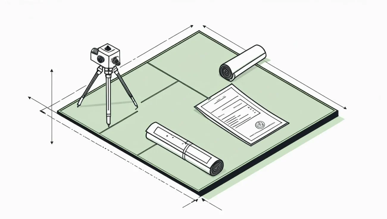
As outlined in the appendices, a customary approach starts with a submission to the land revenue office and then the checking of the land records. One of the office workers comes to the site with measuring instruments and marks lines as per the official map. In the case of Punjab, a good number of these processes have been to some extent reliable due to the PLRA (Punjab Land Records Authority) digitalization. In the same manner, the other provinces Sindh, Khyber Pakhtunkhwa and Balochistan are slowly modernizing with the aim of reducing corruption and enhancing transparency.

Plot Ki Pemaish Ka Tarika
Urban centers like Lahore, Karachi, and Islamabad in Pakistan witness significant demand for plot ki pemaish ka tarika, driven by the expansion of real estate and large-scale construction projects. While urban areas are serviced by plots of land that are lesser in acreage when compared to rural plots of land, they are considerably more expensive, therefore, disputes regarding fractions of land are common and can be very complicated and protracted. The measurement is generally done using the survey maps as well as municipal records.
Housing societies have their own distinct survey departments responsible for ensuring that plots are allocated in alignment with the master plans. Moreover, municipal regulators, including the Capital Development Authority (CDA) and Lahore Development Authority (LDA), are entrusted with monitoring and supervising such activities. Recently, the use of modern urban planning tools such as digital mapping, as well as GPS and GIS technologies, have emerged which enhance the accuracy of plot measurements. The adoption of such technologies is minimizing dependence on traditional approaches, which are often manual, and ensuring precision for investors and buyers.
Traditional vs Modern Techniques of Land Measurement
Until fairly recently, land measurement, or in Pakistani terminology, zameen ki pemaish, used to be performed with basic tools such as measuring chains, ropes, and rods. While simple in their approach, these techniques often led to inaccurate results because of human manipulation or deliberate tampering by unscrupulous officials. A lot of conflicts ensued because boundaries did not correspond with maps or fellow neighboring properties.
Contemporary techniques are based on computer mapping, satellite imaging, and GPS tools. Such techniques enable the use of Total Stations and GIS technology which provide great accuracy and limit the risk of conflicts. The province of Punjab seems to be at the forefront in attempts to modernize Pakistan by digitizing land records and implementing modern techniques of survey. With the increasing rate of urbanization in Pakistan, the use of such technologies is becoming need of the hour.
Land Area Measurement Formula in Pakistan
In Pakistan, zameen ki pemaish translates to land measurement, and applying the correct land area measurement formula is essential. This is because Pakistan uses different measurement systems, both traditional and metric.
For rectangular or square shaped land, the formula is:
Length × Width = Area
For triangular shaped land, the formula is:
Area = ½ × Base × Height
In the case land has irregular shapes, surveyors break these shapes up into simpler shapes, often triangles or rectangles. They calculate the area of each section, and then sum them for the total measurement.
The conventional land measurement system in Pakistan employs units like kanal, marla, killa, and acre. A few are given as:
1 kanal = 20 marlas
1 acre = 8 kanals
1 marla = 272.25 square feet (in Punjab standard)
Thus, after applying the formula in square feet or square meters, the measurement is converted to these traditional units for official records. This approach helps maintain the reliability and accuracy of records. This is particularly important in land measurement for agricultural and urban use.
Zameen Ki Pemaish in Inheritance Matters
Zameen ki pemaish is most commonly required when distributing an inherited property. In Pakistan, farmland is often owned in common by an extended family, and when it is time to divide it, there is contention over how much each heir is entitled to. In these instances, the revenue department carries out the land survey and apportions the shares based on Shariah law and legal provisions.
If precision in measurement is not done, there is always the possibility of an heir perceiving themselves to be short-changed, resulting in a family feud and protracted litigation. Thus, precision in measurement allied with the determination of the estate during the time of succession greatly assists in legal family peace.

Government Role in Zameen Ki Pemaish
The Government of Pakistan has made a number of interventions towards improvement and even the regulation of zameen ki pemaish. The Punjab Land Records Authority and the Sindh Board of Revenue are in the process of digitizing land records. This initiative reduces the reliance on the local patwaris as well as corruption.
Urban planners, by employing satellite images, are increasingly able to curb encroachments and guarantee lawful and precise plot allocations at the stage of land division. Such changes are also aimed at boosting the confidence of the public in property transactions as this is vital in stimulating the real estate sector in Pakistan.
Common Issues in Zameen Ki Pemaish
Land measurement (zameen ki pemaish) in Pakistan remains a persistent challenge, with reforms facing significant resistance. In rural areas, the systematic methods of record keeping that have manual registers are still in use in many districts. Such areas are often disputed locally, meaning they are not free from delays in measurement work. Unauthorized construction on government properties, as well as on adjoining areas, are also common.
The negligence in land and property ownership measurement systems stems from the gaps in the awareness of the general populace. Individuals depend on mere private contracts without checking whether their property is actually measured and recorded officially. Such negligence often causes numerous disputes, and in many cases, results in loss of property rights. In this scenario, property owners stand to benefit if they are well versed with the measurement systems, through insisting on proper measurement and official processes, these issues can be avoided.
The Future of Zameen Ki Pemaish in Pakistan
The trajectory of zameen ki pemaish in Pakistan is very positive, as digitization and modernization bring new levels of precision and integrity to the practice. Land measurement will continue to be in high demand as the housing society construction and agricultural requirements increase. Access to land records, computerized maps, and GPS-based surveys are increasingly being made available to citizens through online means, making the whole process much more secure and streamlined.
In Pakistan, greater public awareness, alongside systematic reforms, can pave the way for a more efficient system whereby land-related disputes, especially regarding boundaries, can be minimized. The anticipated digitization of land revenue records is projected to bring structural reforms, significantly impacting the real estate and agricultural sectors of the country.
Final Thoughts
In the ownership and management of land in Pakistan, zameen ki pemaish is a critical element. Whether concerning rural agricultural fields or urban residential plots in housing societies, precise measurement instills confidence, legal safety, and trust among numerous property stakeholders. Adopting modern approaches and improving awareness of land measurement practices (zameen ki pemaish ka tarika) can ensure greater transparency and equity in property dealings across Pakistan. Also, applying advanced techniques in plot ki pemaish ka tarika would bolster urban planning and mitigate disputes.
Accurate results using the appropriate land measurement techniques ensures such results are articulated in customary Pakistani units, thus facilitating legal transactions. Greater access is noted with the aid of continuous digitization, as well as public engagements. In the case of Pakistan, where land constitutes both an economic and sentimental value, the exactness of land measurement will remain a cornerstone in determining the future of property rights and real estate development.


